Other qalas
|
Other qalas
|
|
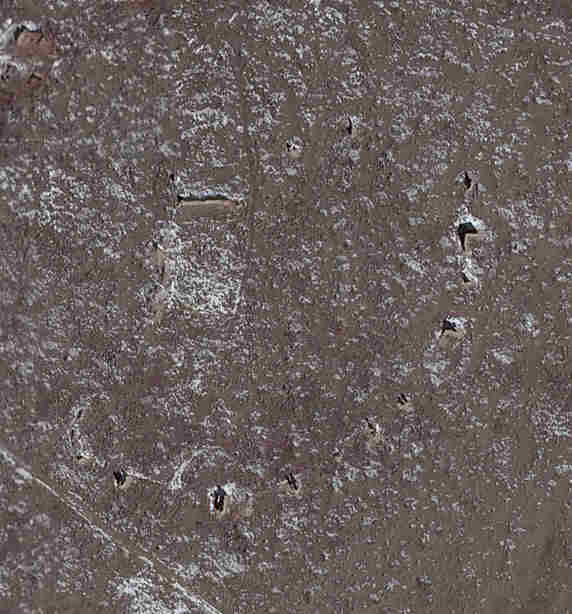
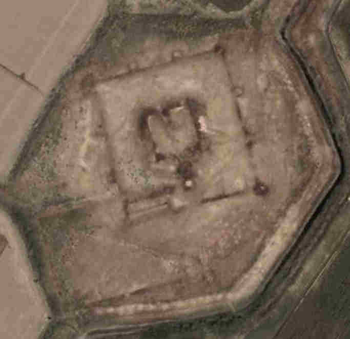
ContentsThe Land of qalasOther qalas in Karakalpakstan Other qalas in Northern Turkmenistan Other qalas in Khorezm viloyati Google Coordinates The Land of qalasIt is sometimes reported that there are 400 qalas in Karakalpakstan. We have never seen a complete inventory, but the No'kis-based archaeologist G'ayratdiyin Xojaniyazov published a list of 76 of some of the most important monuments in 2006. Certainly wherever you look on the large-scale map of the region you can find qalas - so many in fact that the majority are unnamed. There must therefore be hundreds. Indeed in the past there were even more. Many of the small forts were destroyed and ploughed over during the agricultural development of the 1960s and 1970s.To provide a feel for some of the other qalas this page lists just a dozen or so from Karakalpakstan, mainly from the south, along with a couple from northern Turkmenistan and just one from the Uzbekistan viloyat of Khorezm. Other qalas in KarakalpakstanThe following sites are arranged from the furthest south to the furthest north. For the geographical coordinates of each site refer to Google Coordinates.Eres qalaEres qala, sometimes called Aris qala, lies about 15km north east of To'rtku'l on the western edge of the Eresqalaqum Sands in the tuman of To'rtku'l.
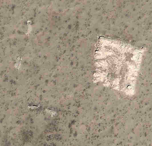
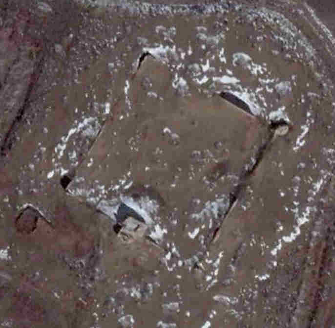
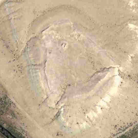
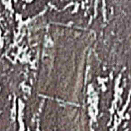
Eres qala.
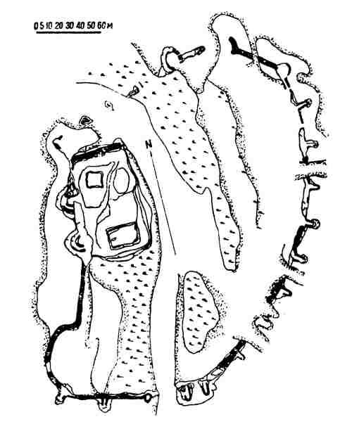
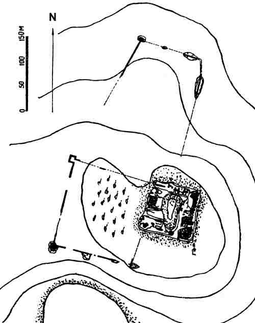
Plan of Eres qala from Sergey Tolstov's "Ancient Khorezm", Moscow, 1948.
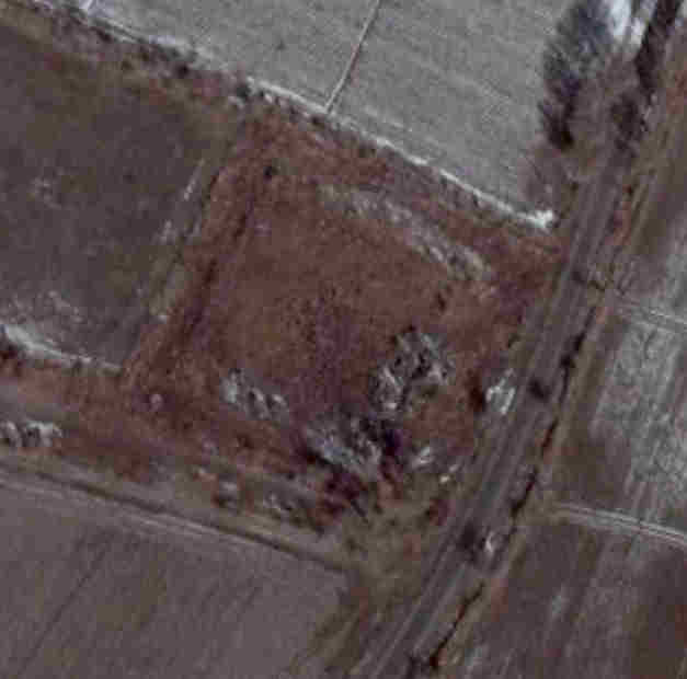
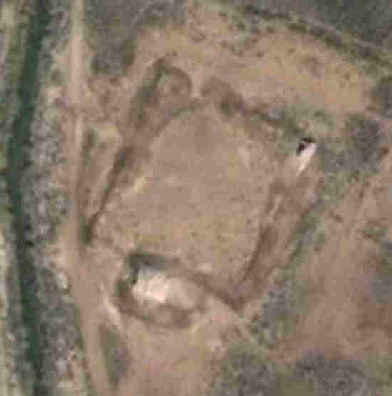
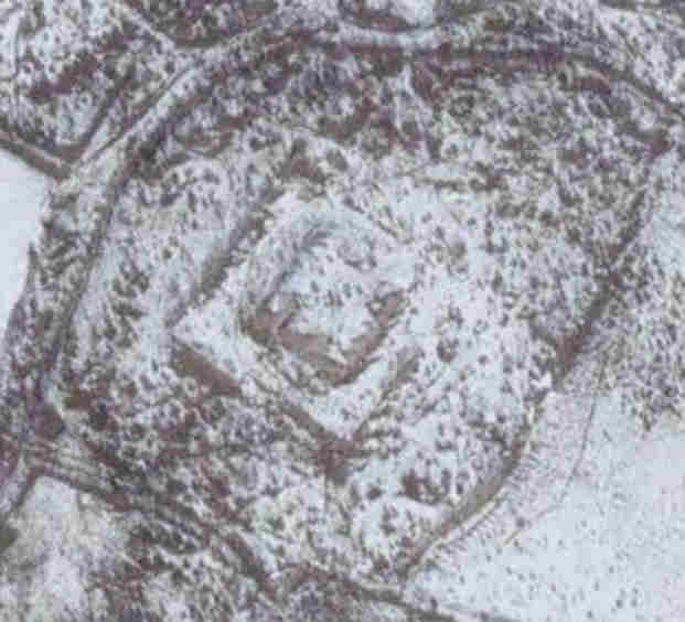
Qurgatıshkan qalaQurgatıshkan qala is 20km north-east of To'rtku'l and 4.5km due south of Qoy Qırılgan qala. It belongs to the tuman of To'rtku'l. It is directly on the left hand side of the road running north from Eres qala.
Qurgatıshkan qala.
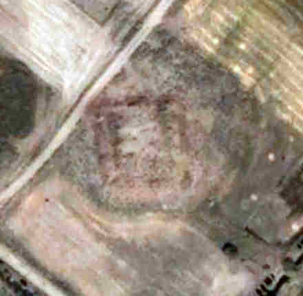
Qumbaskan qalaQumbaskan qala or Kumbaskan Kala lies in the middle of a small residential community just under 20km north of To'rtku'l in the tuman of To'rtku'l.
Qumbaskan qala.
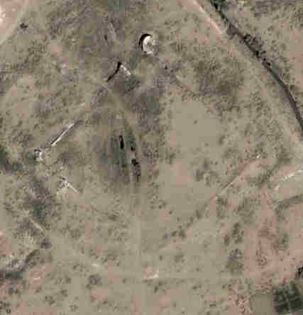
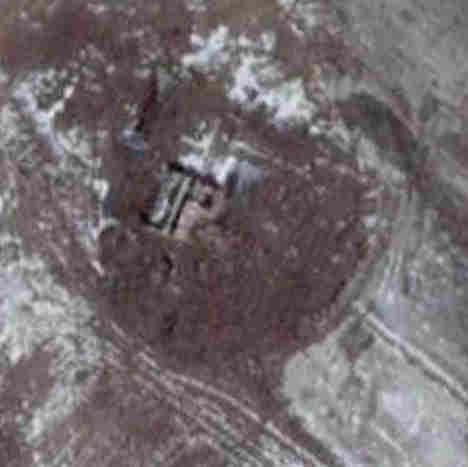
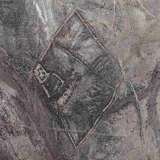
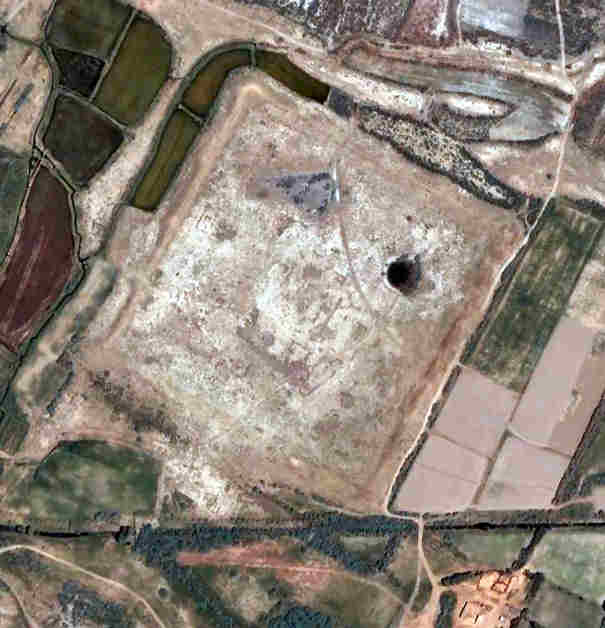
Tuman qalaTuman qala, or Duman Kala, is situated 12km north east of Biruniy on an elevation on the Aq Qum Sands. It can be reached from the road that leaves the A380 half way between To'rtku'l and Biruniy and runs north towards Bostan.
The western enclosure and eastern citadel of Tuman qala.
Plan of Duman Kala (Tuman qala) from Sergey Tolstov's "Ancient Khorezm", Moscow, 1948.
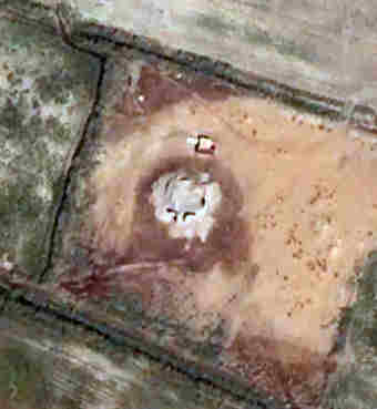
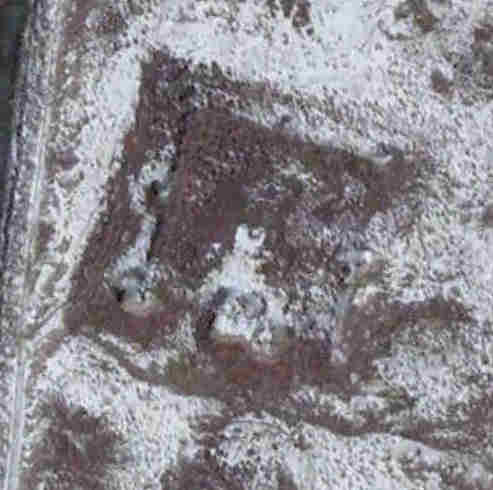
Adamli qalaAdamli qala lies in a remote region 23km north-east of To'rtku'l and 20km south-east of Bostan. It is just 1.7km south of Qoy Qırılg'an qala but unlike the latter is easily accessible, being situated adjacent to a good road. For directions consult Qoy Qırılg'an qala.
Adamli qala.
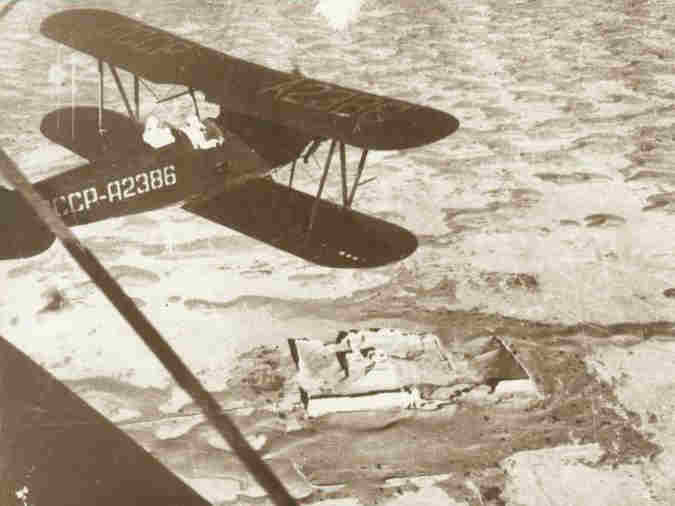
Biplanes conducting an aerial survey for the Khorezm Archaeological-Etnographical Expedition
|
||||||||||||||||||||||||||||||||||||||||||||||||||||||||||||||||||||||||||||||||||||||||||||||||||||||||||||||||||||||||||||||||||||||||||||
|
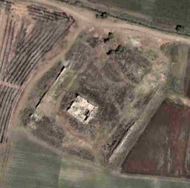
The qala has a rectangular outer enclosure, 90 metres wide and possibly 100 metres long, containing a much smaller square-shaped keep
measuring 20 by 20 metres. It has the appearance of a medieval feudal fort.
|
The almost square-shaped fortress is about 100 metres long on each side and has its walls reinforced with towers at the corners and along the sides.
However on the south-eastern corner there is one much larger rectangular tower.
There seems to be a much less well-preserved enclosure on the southern side.
|
Ashirtam qala appears to be rectangular in shape, measuring approximately 140 by 120 metres, and has some signs of a slightly smaller enclosure within.
|
There is little to see, other than the footprints of two qalas located adjacent to one other. The southern rectangular enclosure measures about
80 by 110 metres, while the northern enclosure is about 90 metres square.
|
It has a small square-shaped enclosure measuring about 90 metres along each side, oriented with its corners pointing towards the four cardinal points.
There is a rectangular structure in the centre of the south-west facing wall.
|
The remains of the fort are small and rectangular, measuring just 40 by 50 metres. There is a structure in the centre of the south-west facing wall.
It might be the remains of a small feudal fort.
|
All that remains are the outlines of two concentric square structures, the outer one measuring just 35 metres along each side.
|
The outer parts of the site seemed to have been ploughed up for farmland. All that remains is a small square-shaped structure, measuring just 15 by
10 metres.
|
The outer defensive wall is rectangular, measuring 80 by 70 metres, and reinforced by a pair of rectangular towers along each flanking wall and a
single rectangular tower at each corner aligned at 45 degrees. The inner fort is about 25 metres square and has an outer structure on its southern side.
It appears to be the ruins of an Afrigid feudal fort.
|
The limited remains of this qala are square-shaped with their corners facing the four cardinal points. There is the layout of an outer wall
approximately 55 metres square and an inner building roughly 27 metres square. It looks like the footprint of a typical feudal fort.
|
Itasxan qala appears to have an outer structure approximately 88 metres square and an inner structure approximately 58 metres square. The latter
has corner towers and a tower in the centre of three of the flanking walls. A much larger structure is positioned in the middle of the fourth wall.
The site appears to be the ruin of a typical Khorezmian feudal fort and residential donjon.
|
The site appears to be square in shape and might be the ruins of an Afrigid feudal fort.
|
The ruin has an irregular shape that seems to have been dictated by the small natural elevation on which it is situated. There are the remains of a
northern and a western outer wall.
|
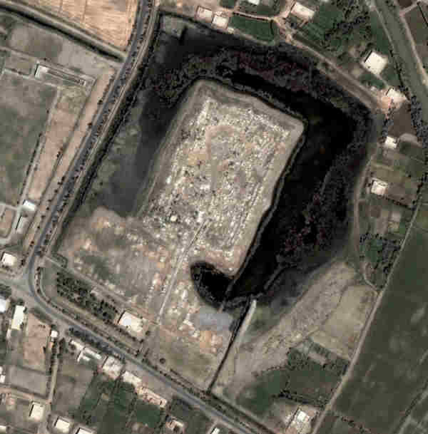
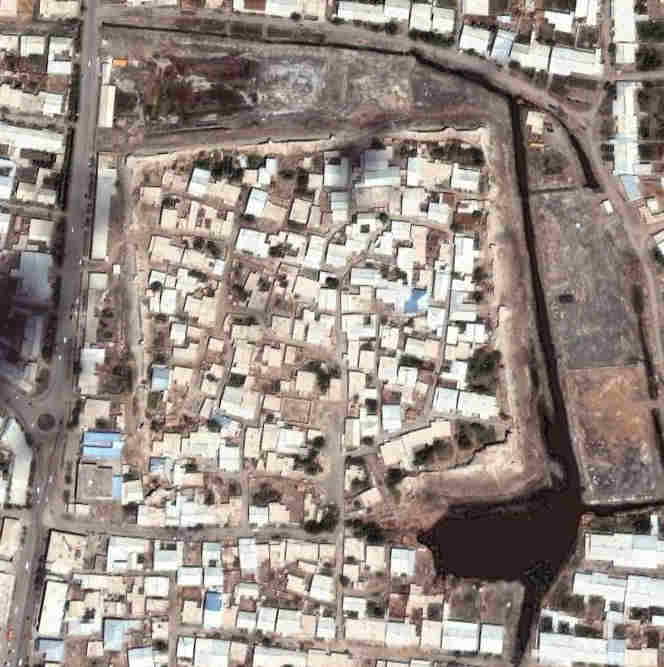
The main qala site has been adapted for use as a cemetery and is accessed by means of a causeway. It lies just north of the hamlet of Shoraxan
and south of the former kolxoz of Chalabash.
|
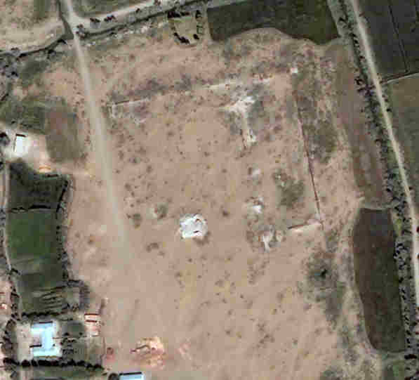
Aq qala, the "White Fort", is a parallelogram shaped enclosure, measuring roughly 380 by 310 metres. There are the remains of a fortress at the
western corner and a small enclosure to its south.
This is a much later fortress dating from the time of the Khivan Khans. Major Herbert Wood of the Royal Engineers sailed past it in 1874 and described
the fort and its adjacent enclosed village as a mass of ruins. It apparently had crenellated walls built upon a mud-brick rampart, circular corner
towers and a surrounding ditch. When the Russian steamer Samarkand entered the U'lken Darya in April 1873 to support the Russian attack on Khiva, the
Khivan fortress fired on the steamer killing or wounding half a dozen of its crew.
Other qalas in Northern Turkmenistan
Unfortunately large portions of northern Turkmenistan are poorly covered by Google Earth, so it is not possible to reference satellite images of some
of the earliest fortifications, such as Kyuzeli Gyr and Kalili Gyr 1, or important later sites like Shahsenem.
|
Some 370 metres from north to south and 230 metres wide, Bederkent qala has an unusual L-shape, possibly dictated by its site. It is currently
surrounded by lakes and bog, which may be the remains of a defensive ditch or moat. It can only be entered at its south-eastern corner.
|
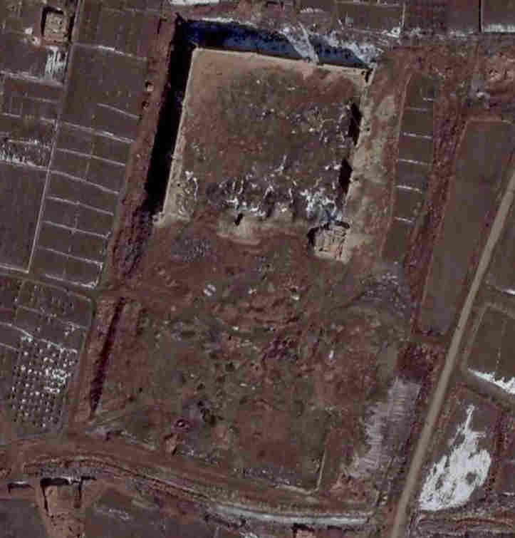
It is an extraordinary rectangular structure, over one kilometre long from north to south and about 660 metres wide, making it substantially larger
than the Ichan qala at Khiva. It has structural features, possibly barbicans, in the centre of its northern and southern walls. Its nature and date
of construction are unknown to us since we have so far been unable to find any reference to the site.
|
All that remains is an almost square enclosure, measuring 320 by 300 metres. The remains of a single rectangular corner tower can be seen on the eastern
corner and there seem to be signs of former buildings or dwellings on the inside. The remains of a wide ditch or moat border the north-west facing and
north-east facing sides.
Other qalas in Khorezm viloyati
|
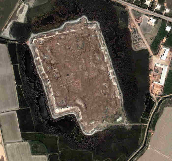
It seems likely that Hazarasp was one of the earliest settlements on the left bank of the Amu Darya. However the current walls are much later, dating
from the time of the Khivan Khans. Most of the southern wall has been demolished for housing, but the other three walls are still intact reaching up
to 10 metres high in places. There were towers located on each of the corners and along the flanking walls, but today only twelve remain. In the south-
east corner there are the ruins of a larger rectangular tower, which the local people call Dev Solgan.
Google Earth Coordinates
The following reference points (in degrees and digital minutes) will enable you to locate the following qalas on Google Earth:
| Google Earth Coordinates | ||
|---|---|---|
| Place | Latitude North | Longitude East |
| Eres qala | 41º 40.035 | 61º 5.500 |
| Qurgatıshkan qala | 41º 42.907 | 61º 7.022 |
| Qumbaskan qala | 41º 43.707 | 61º 1.666 |
| Tuman qala | 41º 44.300 | 60º 52.495 |
| Adamli qala | 41º 44.450 | 61º 7.340 |
| Unnamed qala 1 | 41º 45.086 | 61º 2.644 |
| Unnamed qala 2 | 41º 47.280 | 61º 3.312 |
| Ashirtam qala | 41º 47.750 | 60º 57.173 |
| Kul'baskan qala 1 | 41º 48.375 | 60º 59.347 |
| Kul'baskan qala 2 | 41º 48.440 | 60º 59.342 |
| Qoy qala | 41º 50.388 | 61º 5.912 |
| Air qala | 41º 51.268 | 60º 59.528 |
| Aqtumpek qala | 41º 51.892 | 60º 56.796 |
| Unnamed qala 3 | 41º 53.390 | 61º 0.334 |
| Qosparsan qala | 41º 54.180 | 60º 53.961 |
| Unnamed qala 4 | 41º 55.750 | 61º 8.125 |
| Itasxan qala | 41º 56.300 | 61º 7.560 |
| Quyn qala | 41º 56.987 | 61º 1.382 |
| Bor qala | 41º 58.929 | 60º 54.284 |
| Aq qala | 43º 41.034 | 59º 30.326 |
| Bederkent qala | 41º 32.536 | 59º 59.964 |
| Alikir qala | 41º 48.036 | 59º 11.000 |
| Kandim qala | 42º 4.317 | 59º 11.058 |
| Hazarasp | 41º 18.863 | 61º 5.534 |
 |
This page was first published on 5 September 2008. It was last updated on 8 March 2012. © David and Sue Richardson 2005 - 2015. Unless stated otherwise, all of the material on this website is the copyright of David and Sue Richardson. |