|
Location
Janbas or Jambas qala in Karakalpak, or Dzhanbas Kala in its Russian transliteration, is about 47km north east of To'rtku'l in the To'rtku'l
tuman of Karakalpakstan.
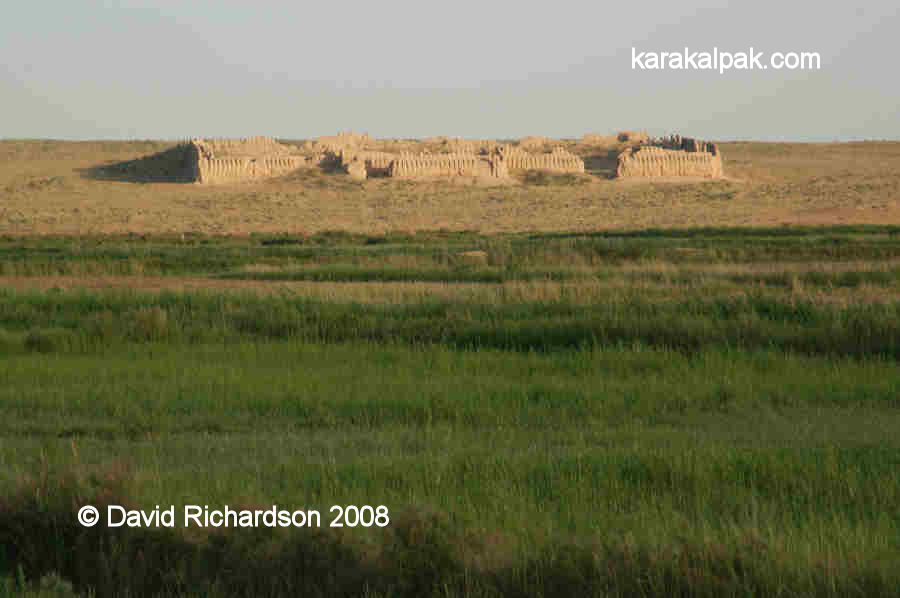
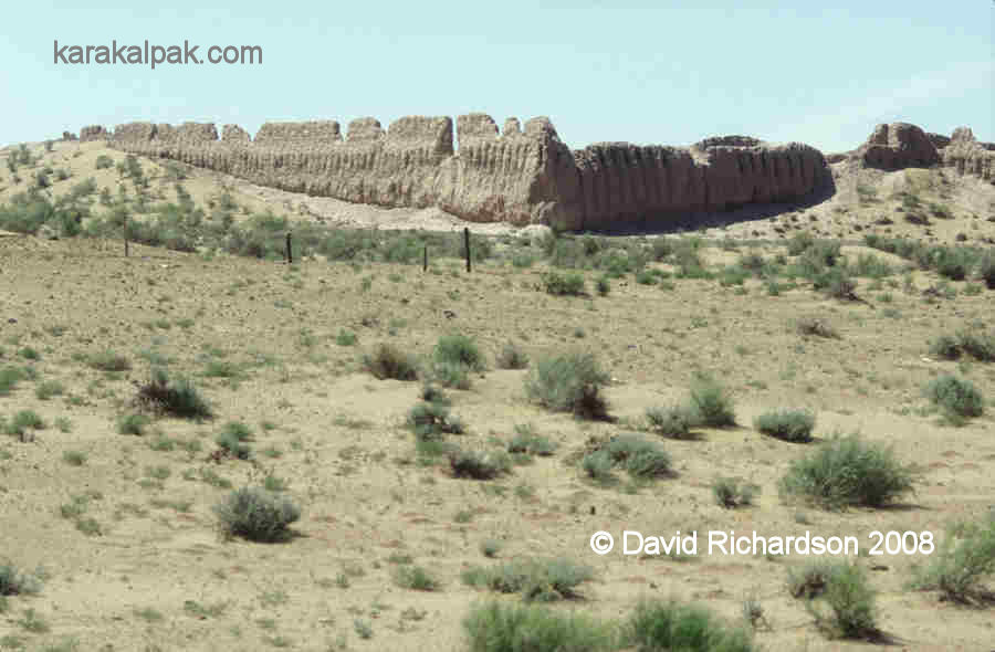
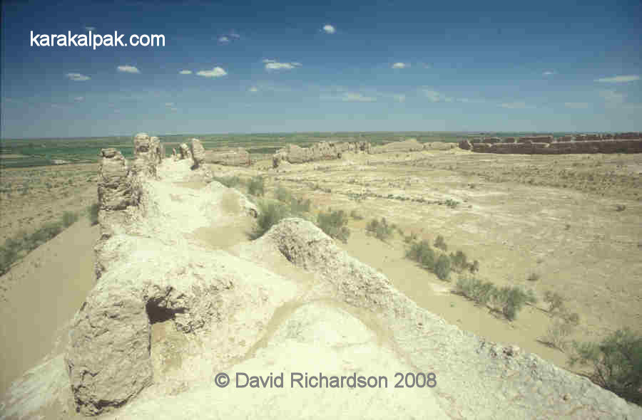
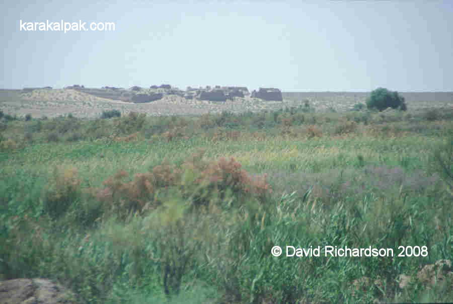
View of Janbas qala from the road.
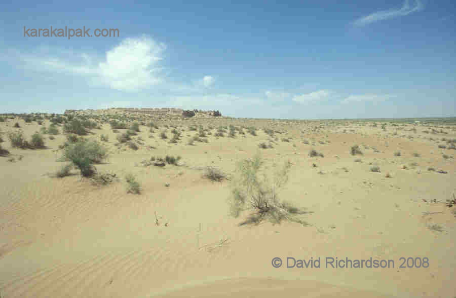
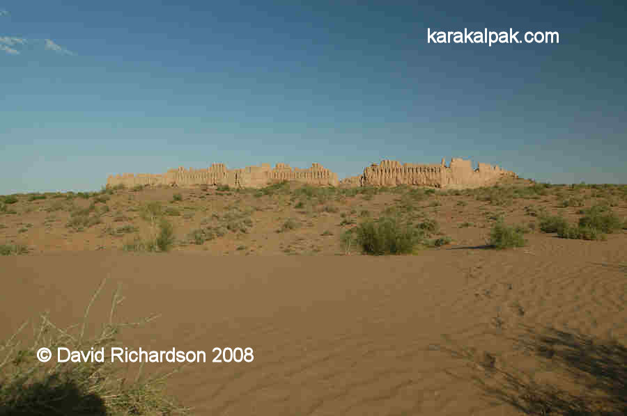
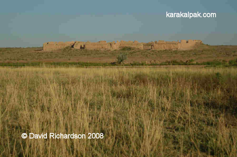
It is located in a remote region on the last of a chain of low hills that stretch out to the east from the Sultan Uvays Dag. It is dramatically
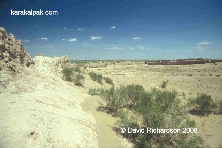
positioned on the side of a low ridge overlooking the plain below. The region surrounding the fort is now fairly barren desert, but the valley below
the fort is currently irrigated and was once watered by an eastern branch of the southern Akcha Darya delta.
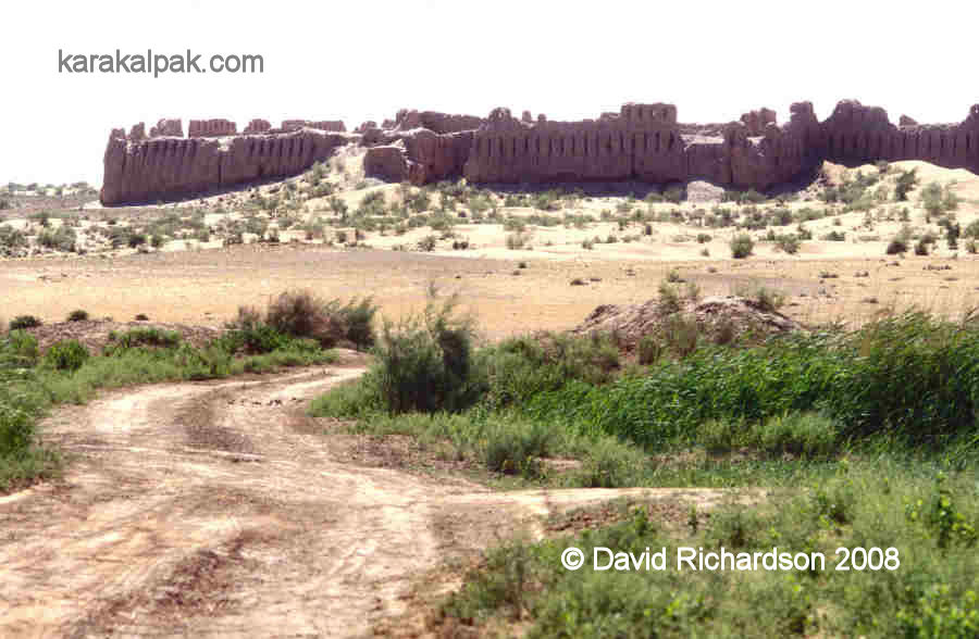
Entrance to Janbas qala.
In our opinion Janbas qala is one of the "must-see" qalas of Ancient Khorezm.
Excavations
Janbas qala was one of the earliest monuments to be excavated directly by Sergey Tolstov and other members of the early Khorezm Archaeological Expedition.
It was investigated in 1938.
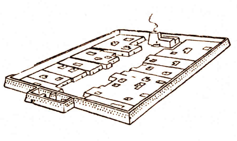
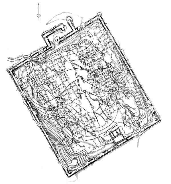
Plan of Janbas qala. From Sergey Tolstov's "Ancient Khorezm", 1948.
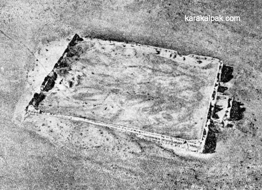
Aerial photograph of Janbas qala.
From Sergey Tolstov's "Following the Tracks of Ancient Khorezmian Civilization", 1948.
Aerial photography of the site took place between 1946 and 1948. The walled city is oriented with its corners facing the four cardinal points.
It slopes down toward the north-west.
Janbas qala
In Karakalpak janbas and jambas are both words for side or flank, spoken in different regional dialects. Janbas qala is therefore the
citadel on the side or flank of the hill. It remains a mystery to us why it was built on the side of the hill and not on the more strategic high point
of the ridge.
Janbas qala - the citadel on the flank of the hill.
It is possible that Janbas qala was one of the earliest frontier fortresses in Khorezm, built on the very edge of its eastern border after the province
gained its independence from the Persian Achaemenid Empire, possibly in the early 4th century BC. During its occupation it was surrounded by many small
agricultural settlements and field and irrigation systems.
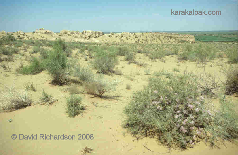
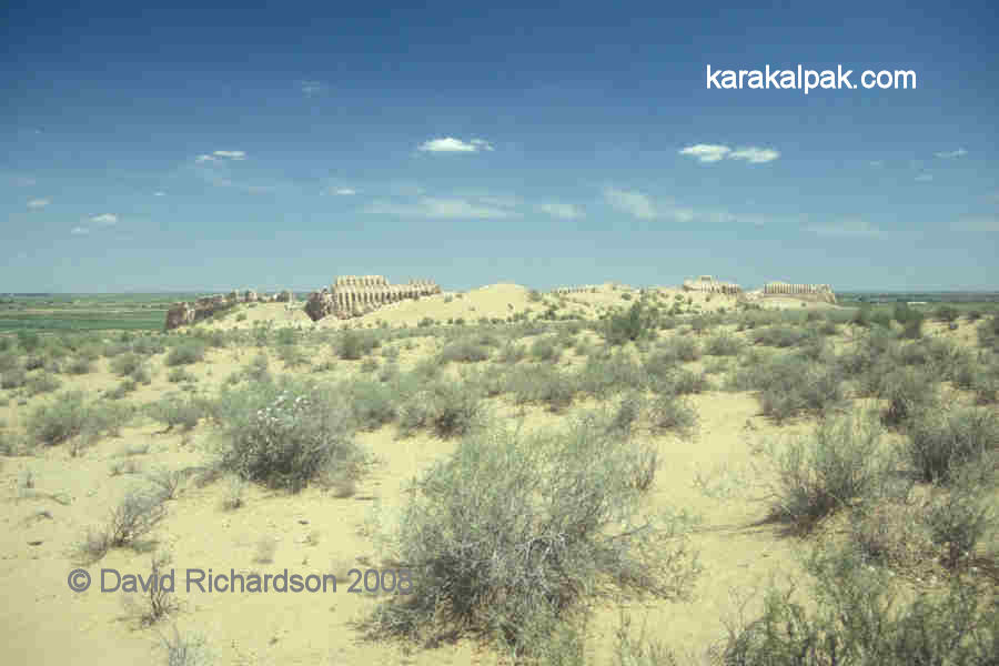
Today Janbas qala is surrounded by desert. Yet it still overlooks the modern oasis below.
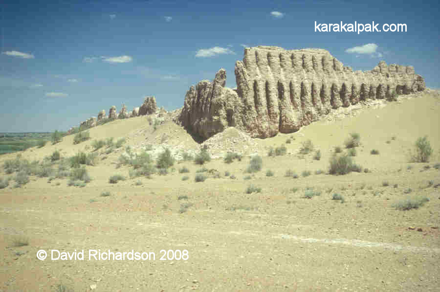
Janbas qala has one of the most archaic fortification systems dating from that Early Antique period, with a slightly irregular rectangular layout � 200
metres long by 170 metres wide. All four of its flanking walls are in relatively good condition, reaching in places up to 20 metres in height.
The impressively high walls of Janbas qala on its southernmost corner.
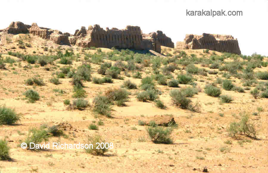
The double walls contained two archers' galleries, one above the other, with two tiers of closely spaced loopholes penetrating the outer wall. It is
likely that the walls had an uncovered third storey archers' gallery since the top of the walls were castellated. The citadel had a single entrance
located in the middle of the north-west facing wall. It was protected by a rectangular labyrinth gateway, with visitors forced to turn right into a
heavily defended courtyard before gaining entry into the citadel. Here they could be inspected prior to admission while being covered by defending
archers, especially on their left undefended side.
Janbas qala from the northernmost corner showing the rectangular entrance gate.
View of the eastern corner of Janbas qala.
Unlike contemporary Ayaz qala 1, however, Janbas qala has no towers to defend its flanks. This meant that the fort was potentially vulnerable from an
attack on the lower sections of its walls. The military architects had attempted to overcome this design weakness by including some steeply inclined
loopholes so that some archers could fire down along the face of the walls. Tolstov believed that this design of loophole could be traced back to the
time of the Assyrians. It was subsequently used in Persia by the Achaemenids and later by the Parthians but then seems to have become obsolete.
Certainly the design never caught on in Khorezm - all of the other frontier fortresses were constructed with defensive towers instead.
View of the south and western flanks of Janbas qala covered with wind-blown sand.
Most of the normal embrasures were oriented at a right angle to the wall, only permitting forward fire. However after every 20 or 30 normal loopholes
there was a set of three special loopholes accessed by the archer from a small round-arched niche, set into the outer wall. One loophole faced forward,
one was angled to the right and a third angled to the left. There were also pairs of angled embrasures at each corner of the citadel. Given the enormous
number of fortress loopholes � over one thousand - the citadel must have been manned by a large number of defenders. As the total population was likely
to have been no more than 2,000, it is possible that the defenders included women as well as men. It was of course a tradition in many of the nomadic
societies of that time for both sexes to be trained in military skills from an early age.
Interior of Janbas qala, looking towards the north.
The interior of Janbas qala was completely filled with residential buildings. These were arranged in the form of two separate blocks of communal housing,
located on either side of a wide central main street. Each block contained some 150 to 200 rooms and could therefore accommodate some 500 to 1000 persons.
Tolstov found that the tamg'as or symbols scratched onto the mud bricks used to build these residential blocks were different. One block had one
common symbol and the other block had a different common symbol.
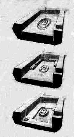
Schematic layout of the interior of Janbas qala. From Tolstov.
Tolstov somewhat fancifully interpreted this to imply that the citadel had been occupied by the two separate wings or divisions of a single tribe.
Another feature of Janbas qala was the location of a monumental building at the far end of the main street from the entrance. This was excavated by
Tolstov in 1939. It contained an oval pedestal with the remains of ashes and was assumed to be the remains of the city's main fire temple.
Tolstov's alternative interpretations of the fire altar at Janbas qala.
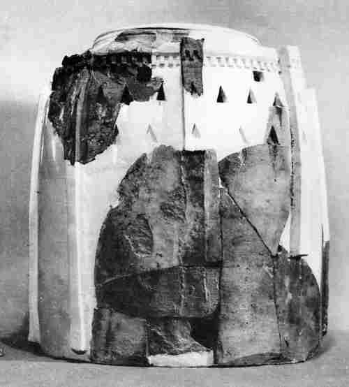
During much later excavations in the 1960's archaeologists discovered a collection of ossuarys dating back to the 1st century AD on the outskirts of
Janbas qala from what may have been a local necropolis. Made of baked clay, the ossuarys were in a wide range of styles, including a woman sitting on
a throne, a horse-rider, and several shaped like toy fortresses with loopholes and towers.
Fort-like ossuary from Janbas qala.
Excavations within Janbas qala revealed a rich selection of finds, including ceramics, terracotta statuettes, metal ware, bracelets, signet-rings, jade
and large numbers of glass beads that may have been imported from the northern Black Sea region. All this evidence indicated that Janbas qala was only
occupied from the 4th century BC up until the 1st century AD. The absence of any finds of coinage shows that it had already been abandoned by the
2nd century AD.
From the large number of finds of metal arrow heads inside the town, Tolstov concluded that the citadel must have been overwhelmed by nomads in the 1st
century AD. He conjectured that the wall to the south of the entrance gate had been breached by battering ram and that this had been followed by a
fierce internal fire fight as the attackers engaged the defenders within the citadel.
An alternative possibility is that the town might have been abandoned because of a failure in the local water supply. We know that in the 2nd century AD,
during the early Kushan period, the Amu Darya began flowing back into the Caspian via the Uzboy, reducing the outflow through the Akcha Darya. Conversely
we know that other settlements on the Akcha Darya were from time to time badly affected by flooding. It is clear from the chemistry of the clay at
Janbas qala that part of the site was once flooded. In time we may get a better understanding of what brought the occupation of Janbas qala to an end.
|
|
Views of Janbas qala just before sunset.
Google Earth Coordinates
Unfortunately the region of Janbas qala is only covered by low resolution satellite imagery on Google Earth. Its approximate position is as follows:
| | Google Earth Coordinates |
|---|
| Place | Latitude North | Longitude East |
|---|
| Janbas qala | 41º 51.480 | 61º 18.245 |
| | | |
Note that these are not GPS measurements taken on the ground.
Visit our sister site www.qaraqalpaq.com, which uses the correct transliteration, Qaraqalpaq, rather than the
Russian transliteration, Karakalpak.
Return to top of page
Home Page
|